|
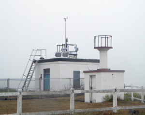
Marrowstone Point Light Overview

In the spring through the fall strong southerly winds can develop as storm fronts approach the coast. Marrowstone Island benefits from the Olympic Mountain rain shadow and will often be dry and overcast while the rest of Puget Sound is getting drenched.
Conditions at Marrowstone Point are strongly affected by tidal flow. Sailing can be difficult in strong outgoing tides. However, there are several other good sailing locations on Marrowstone Island including Oak Bay and East Beach when conditions dictate you should go elsewhere.
Marrowstone Point has lots of parking, an outdoor restroom and sheltered wind breaks. People attempting to sail here should be proficient jibing in rough windy conditions and have “pointing” skills.
|
 |
Local Expert?  Edit this Page! Edit this Page!
|