|
Beavertail Overview
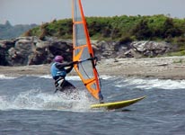
This meter can give low readings relative to places you can actually sail. Beavertail is a rock outcropping at the head of the Narragansett Bay. 5/10/09 was a good example of a low offshore reading where Rose Island showed 25 knots all day with Beavertail registering an erratic 5 knots. Second beach is reliably good for kitesurfing once this meter reads 11 knots and for windsurfing at 13 knots.
The closest realistic launch to the meter is at Fort Getty although surfers will surf right in front of the rock. This park has a good southwest-facing beach. Some claim this beach is always windier than the URI Bay Campus, directly across from Fort Getty. Normally, the Campus is sailed in northerlies and southerlies. Under these conditions, small to large swells run at right angles to the shore. At the end of a typical summer day south westerlies can turn westerly at the Bay Campus and most adjacent beaches like Wickford thus making a tough slog back home for western shore sailors while those at Fort Getty and in the East Passage (between Newport and Jamestown) are still planing.
|
 |
Local Expert?  Edit this Page! Edit this Page!
Regional Directory
|
|
Shops,
Schools,
Clubs,
Events,
Food,
Lodging,
More,
|
|
 |
|
| Season: |
Year round but April-October is most popular |
|
| Water: |
Temps in Winter 35 F to 65F in summer |
|
| Ability Level: |
Beginner-Advanced - depends on wind |
|
| Familiness: |
Great in lighter winds - Optimist Dinghy regattas are held here. |
|
| Parking: |
Nominal fee in season at Fort Getty |
|
| Launch: |
Be careful of rocks in the water. |
|
|
 |
|
Maps & Directions
For Fort Getty, take exit 138 at the Newport Bridge toll booth and head south on East Shore Road. Shortly past Jamestown Harbor, make a right onto Beavertail Road, cut across the island, and go past Mackerel Cove over a short causeway. Fort Getty will soon be to your right and is well marked by signs. For the URI Bay Campus, go to the southern intersection of Routes 1 and 138. (138 intersects Route 1 in two places). Directly across the intersection from 138, go east on Bridgetown Road (which curves down a hill before it crosses Route 1A). Continue through the light to the campus. Near the water's edge, take a left and look for a small picnic area.
|
|
|
Sensor Notes
The sensor is located on a radar tower at the southern tip of Beaver Neck, just below Jamestown. This meter is at the head of the Bay so in a Southwester will be the lowest reading in the area. Winds downwind increase dramatically as the bay compresses the breeze. In west to northwest it reads low in general. Members report Beavertail matches Point Judith ninety percent of the time, with the greatest discrepancies in offshore winds (which are northerly and west-north-westerly at Point Judith). However, the northerly and northwesterly winds should increase to the strength of the meter as you sail further away from shore. The Beavertail meter provides the most accurate reports for Block Island Sound. During the oil spill from the grounded North Cape barge in January '96, both National Weather Service data and WHL data were fed into the oil spill models. Of all data sites public and private, the WHL meter at Beavertail gave the most accurate prediction of when and where the spill would make landfall on Block Island.
|
|
|
